Time in the early era was always calculated on the basis Sun’s position in the sky.
Solar Noon is referred to as the phenomena when the sun is as high in the sky as it will get for the day.
Sunchart is revolves around the concept of the Sun following an eliptical path around the Earth.
From a northern hemisphere perspective (where most people are), everything spins counter-clockwise. This is why it is noon in NYC three hours before it is noon in San Francisco
The earth is tilted 23.5 degrees, which is what gives us seasons.
The equator is facing 23.5 degrees below the sun on summer solstice and is facing 23.5 degrees above the sun on winter solstice.
During equinox, the sun will be right over the equator.
As depicted below, the sun chart helps depict how the sun will move throughout the year.

X axis represents Azimuth angles:
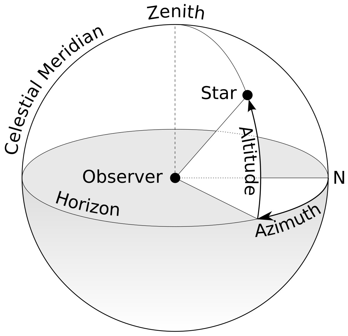
The basic position of the sun at any instant can be described by two angles, the solar altitude (angle gamma) and azimuth (angle alpha).
The reference plane for the solar altitude is the horizontal plane. The altitude is the angle between the line to the centre of the sun and the horizontal plane. When the sun is on the horizon, the solar altitude is 0°; when directly overhead 90°.
The reference plane for the solar azimuth is the vertical plane running north-south through the poles. The azimuth is the angle between true south and the point on the horizon directly below the sun. By convention, it is negative before noon and positive afternoon. The azimuth is referenced to due south in the Northern hemisphere.
Y-axis represents Elevation of the Sun:
The sun is the highest when it is over the meridian or longitude of where you are located. Meridians or lines of longitude are lines that indicate where a location is in the east and west direction. These lines go from the north to the south poles along the surface of the earth. Meridians or lines of longitude are perpendicular to lines of latitude.
We can use the sun charts to help determine how much solar energy will be at a certain location and there are devices, which can superimpose trees and other objects that cast shadows onto different sun charts.
The two most popular devices are the Solmetric Suneye and the Solar Pathfinder.
We will be exploring these in the following sections.